
Trace Mamaroneck Street Directory Records
Ownership records along a Village of Mamaroneck street are not kept in one village roll. First establish which side of the Mamaroneck River holds the parcel. The west-side village area is assessed by the Town of Mamaroneck, while Rye Neck on the east side uses the Town of Rye system. That distinction comes before a name search, because a sound address can produce no result in the wrong town portal. An assessment owner is a title or tax-record lead, not proof that a particular person is living there.
- Normalize the address as printed, retaining any older spelling or house number found in a document.
- Use the correct town assessment record to capture the property location, parcel key, owner of record, mailing address, assessment details, and deed reference.
- Open the county parcel viewer, select the same polygon, and record the print key and property-address label.
- Search the current owner or deed reference in the county land index. The seller on a purchase deed becomes the next name for a backward title search.
- Use Village permit history and an address-first directory or newspaper file only as supporting, dated evidence about the address.
Each source answers a different question. The parcel roll ties a street address to a tax record, the deed identifies parties to a recorded transfer, and a historical directory may place a household at an address for one edition. Keep those labels separate when reading a Village of Mamaroneck street directory.
Note: A river-side jurisdiction check prevents a correct street address from being searched in the wrong town assessment system.
Mamaroneck Street Directory River Seam
The Village of Mamaroneck transferred its own assessing function to the Towns of Mamaroneck and Rye in 2014. A street search therefore starts with municipal geography rather than an assumed village assessor. The Town of Mamaroneck offers the Online Tax Portal. For a Rye Neck parcel, use the Town of Rye’s Image Mate Online public viewer for RPS data, tax maps, and property images. Village tax-roll material can still help with village tax context, but it does not replace the applicable town’s assessment record.
Tax districts, school districts, and postal wording can cross or differ from village boundaries. A local-looking mailing address also does not settle the issue. Confirm the parcel’s location on the county map, then use the assessment jurisdiction that applies to that parcel. This is especially important where Rye Neck and Village of Mamaroneck labels appear together in older material.
Mamaroneck Street Directory Search Keys
The Town of Mamaroneck tax search is an address tool with a narrow input rule. It accepts one search criterion at a time. Use Property Address when the street number is known, Tax Map # when a section-block-lot is available, or Owner Name when checking a recorded owner. The owner option uses partial matching across the entire entered name, so a broad entry can return too much. A tax-map value uses dashes and no spaces.
| Town Mamaroneck field | Input type | When to use it | Format or limit |
|---|---|---|---|
| Collection | Dropdown | Choose the current collection when needed | Default or optional |
| Tax Map # | Text | Use a known parcel identifier | Dashes, no spaces |
| Property Address | Text | Start a by-address street search | One alternative criterion |
| Owner Name | Text | Check a title or tax-record name | Partial entire-name match |
| Search | Button | Run a narrowed query | Use one criterion at a time |
An official tax-search screen shows the three practical lookup paths. The screenshot makes the one-criterion warning easy to spot before entering an address.
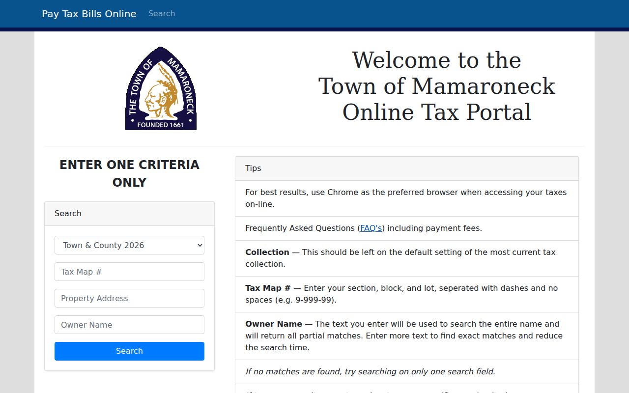
Once a result is found, preserve the parcel key and situs address for the next record rather than treating a mailing address as a street-level resident match.
Read Mamaroneck Address Record Fields
A parcel card has several address-related fields, and they do not all mean the same thing. Property location, also called a situs address, identifies the physical parcel. The current owner is the person or entity shown on the assessment roll. The owner mailing address tells where a tax bill is sent. It can be a useful contact clue, but it does not prove occupancy at the property. Deed information points toward the recorded document that should be verified in the County Clerk’s land records.
- Parcel
- A tax-map unit of land used to connect assessment and map records.
- Situs address
- The physical property location, which may differ from the tax-bill mailing address.
- Plat or legal description
- The subdivision, lot, or other legal land wording used to identify property in a deed.
- Criss-cross directory
- An address-first directory section that can pair a printed address with an occupant for that edition.
Other useful assessment fields include property class, exemptions, land and total assessment, parcel size or grid information, and district labels. Class and exemption codes describe the tax record, not a current household. A sketch or photo, where a portal shows one, is likewise a parcel characteristic rather than a statement about who is present.
Browse Mamaroneck Streets in GIS
The Westchester County Municipal Tax Parcel Viewer supplies a shared map layer across the Village of Mamaroneck. Its Mamaroneck Village Parcels layer is 378. Pan and zoom until the street’s parcel polygons are visible, click one parcel, and write down the property address and print key. The layer metadata identifies PROPADDRESS, PRINTKEY, and MUNNAME as useful labels. Use the print key to return to the applicable town roll or to check a deed trail.
The viewer is a locator, not a survey. The county service warns that parcel edges are approximate and may contain gaps or overlaps. Select only the layers needed for the question, such as parcel or district context, and confirm legal boundaries with a definitive tax map or recorded description. Its map service supports advanced queries and has a 2,000-record maximum, which is another reason to work from a selected address rather than a broad extraction.
The county GIS parcel viewer is the visual bridge from a Village of Mamaroneck street directory search to a printable tax key.
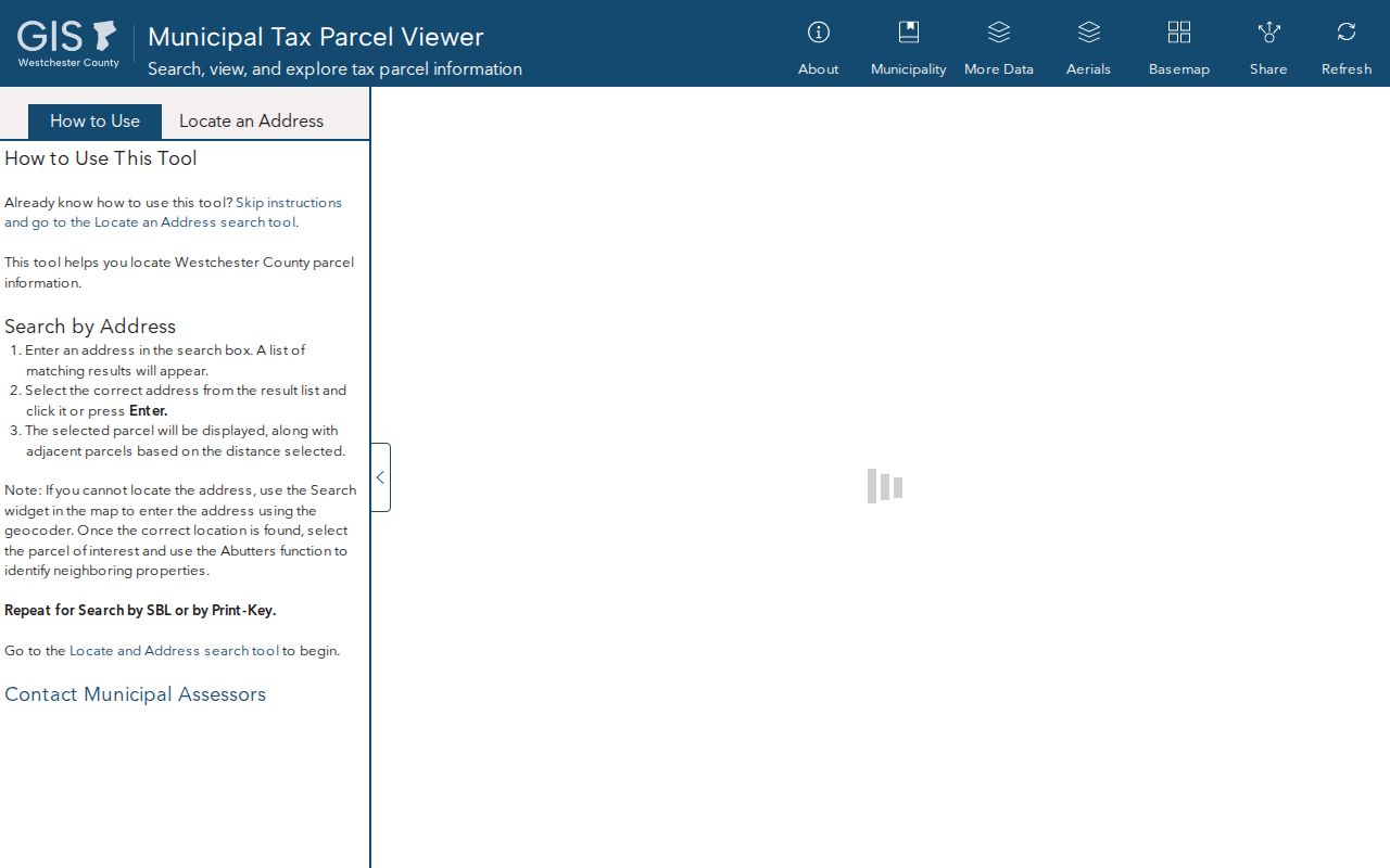
The parcel map is most useful when its address and print key are carried into the town assessment system, not when its approximate linework is read as a final boundary.
Mamaroneck Street Directory Records by Address
Several public systems can be keyed to one Village of Mamaroneck address. They overlap, but they are not interchangeable. The tax roll gives the present assessment-side record. GIS places that record on a parcel. Deeds provide recorded parties and legal descriptions. Permit history dates work at the site. Voter lookup is limited to an exact individual check rather than an open street browse.
| Address record | Local custodian | What it can show | Access channel |
|---|---|---|---|
| Assessment / tax roll | Town of Mamaroneck or Town of Rye | Parcel, situs, owner, tax mailing, class, assessment, exemptions | Public town portal or roll |
| Village parcel map | Westchester County GIS | Polygon, property address, print key, municipality label | Free county viewer |
| Recorded deed | Westchester County Clerk | Parties, legal description, recording trail | WRO index, paid/login image route, counter or archives |
| Building history | Village Building Department | Applications, certificates, permits, and inspection dates | City Squared login, request, or department file |
| Historical address listing | Library and local-history collections | Printed address-first household clue for an edition | Directory, microfilm, archive, or appointment route |
A parcel number or print key can connect the roll to mapped land and permit material. The street name connects the current address to a historical directory. If the question changes from an entire street to one named person, use the separate Village of Mamaroneck resident lookup workflow rather than assuming an address record alone confirms identity.
Note: A current assessment record can lag a transfer, so the County Clerk deed is the better source for the recorded conveyance.
Trace Mamaroneck Street Deed Chains
Westchester Records Online offers Land, Legal, and Maps research and advertises deeds reaching back to the eighteenth century through recent records. The research did not establish an exact online cutoff. Search the current owner or grantee, locate the purchase deed, read the seller or grantor and legal description, then search that seller as an earlier grantee. A grantor is the party transferring an interest; a grantee is the receiving party.
Remote document images require a login and payment, listed as $20 per day or $1,200 per year in the research. If imagery or an older instrument is unavailable online, the County Clerk counter and archives are the documented fallback. Keep the section-block-lot, subdivision wording, lot description, and book-page reference with the street address, since a street number can change while the legal description still links the chain.
Mamaroneck Street Directory Permit Tip
Village City Squared instructions describe parcel-history searches by street address, owner, or section-block-lot. That route can surface permits, applications, certificates, and inspection dates. The service requires a login and is not the payment portal. When an item is not visible, ask the Village Building Department for the underlying file or use a records request. Older scans can be absent, indexed under a variant, or available only through a building-file request.
Town of Mamaroneck’s 2026 budget reported 26,405 new Laserfiche files and said 98% of permits, licenses, and FOIL requests had moved online. That is useful evidence of an active digitization effort, not a promise that every older address file is already available. A permit dates a project or inspection. It does not establish who occupied the address at that time.
Recover Mamaroneck Street Directory History
For a past household, use the address-first or criss-cross section of a directory, then check its alphabetical entry, newspaper microfilm, yearbooks, probate, cemetery material, or census record as appropriate. The Mamaroneck Public Library, Mamaroneck Historical Society, Village Historian, and regional collections are the practical local-history channels. The library can help locate reverse directories and newspaper material, while the Historical Society and Historian may require an appointment for records not online.
No official source located a village-wide renumbering date. The reported 2005 North Barry Avenue Extension decision is a road-history clue, not proof of a general renumbering. When an address does not line up across eras, compare historic maps, the deed’s legal description, street guides, and archival files before deciding two entries describe the same place. The historical shelves themselves are treated in more detail in the Village of Mamaroneck city directories.
Mamaroneck Street Directory Privacy Limits
A Village of Mamaroneck street directory can identify a parcel and its public assessment owner, but it cannot settle every question about the people connected to an address. New York’s voter lookup is an exact individual tool requiring name, date of birth, county, ZIP, and address information. It is not a public streetwide browse. Full voter-file access carries an elections-purpose condition, and confidential voter records are omitted. DMV information is protected, and private utility or delivery records are not a public street source.
New York’s Address Confidentiality Program can provide a substitute mailing address for eligible participants, while confidential voter registration keeps a protected record outside public inspection. A missing name is not proof that no one is connected to an address. Ask the appropriate custodian about a record’s scope and use a direct, lawful research purpose.