
Village of Mamaroneck ZIP Code Coverage
The Village of Mamaroneck postal directory has one normal postal anchor for village street addresses: 10543. It includes addresses commonly styled Mamaroneck and Rye Neck, yet its delivery area reaches beyond the village’s legal boundary. Nearby ZIPs can appear in town, regional, or mailing contexts, but they are not normal village street coverage. Treat a ZIP as a mail-area label first, then verify the municipal and assessment jurisdiction before drawing a conclusion from it.
| ZIP | Areas covered in relation to the village | Post office | Record-search note |
|---|---|---|---|
| 10543 | Primary postal ZIP for the village, including commonly styled Rye Neck addresses; also reaches outside the legal village | Mamaroneck Post Office | Delivery geography, not proof of municipal boundary or occupancy |
| 10538 | Village of Larchmont and adjacent Town of Mamaroneck area | Larchmont-area postal service | Not a normal Village of Mamaroneck street ZIP |
| 10580 | City of Rye and nearby regional references | Rye postal service | Verify east-side records with USPS and town jurisdiction |
| 10528 / 10583 | Harrison and Scarsdale regional context | Respective post offices | Boundary-check values, not village street coverage located |
The Mamaroneck Post Office is at 309 Mount Pleasant Avenue, Mamaroneck, NY 10543-9998, with retail phone 914-698-3229. USPS also lists 800-275-8777 for general help. Exact carrier-area boundaries and a ZIP+4 belong in the USPS ZIP Lookup, not in an assumption based on a place name.
Village of Mamaroneck 10543 ZIP Code
10543 is the practical starting point for a village address, but it needs a second check. The Village of Mamaroneck crosses the Mamaroneck River. Parcels west of the river are assessed in the Town of Mamaroneck; village parcels in Rye Neck on the east side are assessed in the Town of Rye. The postal city can remain Mamaroneck on both sides. That split is why the correct assessor, tax map, school district, or permit custodian may change even while the postal ZIP remains the same.
Regional records can make the postal picture look wider than the village. Larchmont and adjacent Town of Mamaroneck material may use 10538. City of Rye references may use 10580. The 10528 and 10583 values appear in broader Harrison and Scarsdale boundary context, not as village street coverage. A result in one of those nearby areas calls for an address-by-address check, not a conclusion from the word Mamaroneck in a record.
USPS offers address, city/state, and ZIP-to-city modes. Use the address mode to normalize delivery information, and the city/state mode to see the postal results associated with a locality. USPS cautions that a ZIP result does not confirm a person or company at an address. For a complete street-level record trail after an address has been narrowed, use the Village of Mamaroneck by-street directory.
Note: Rye Neck is a village neighborhood name and town-side clue, not a separate incorporated postal municipality.
Village of Mamaroneck ZIP Code Directory Steps
The reliable postal workflow moves from delivery information to the property key and then to the legal boundary. Neither town assessment portal exposes a public ZIP filter, so a whole-ZIP name list cannot be built from them. Instead, use a verified address or parcel number. For a whole ZIP question, the better public sources are village tax-roll PDFs, aggregate election statistics, Census or ZCTA context, and parcel map layers, rather than a scraped list of people.
- Use the USPS lookup to verify the delivery ZIP and standardize the address.
- Decide whether the parcel is on the Town of Mamaroneck or Town of Rye side of the village.
- Search the applicable tax system by address, owner name, or parcel key, then keep the situs and tax mailing address separate.
- Open the county parcel viewer to check whether the parcel lies inside the Village of Mamaroneck boundary.
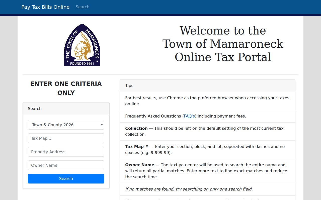
Town of Mamaroneck’s tax search accepts one practical criterion at a time: tax map number, property address, or owner name. Owner name is a partial entire-name search, and a tax-map number uses section-block-lot with dashes and no spaces. This is an address workflow after postal verification, not a ZIP search.
Village tax-roll PDFs add useful context after the parcel is identified. They display parcel identification, owner and mailing address, property description, dimensions, exemption, values, class, and deed information. Those fields describe the tax record. They do not turn a postal label or an owner mailing address into proof that someone occupies the property.
The portal’s search choices are visible in this official capture.
For an east-side parcel, use Town of Rye Image Mate, which provides public RPS data, tax maps, and property images after entry to its viewer.
Village of Mamaroneck ZIP Code Boundary Check
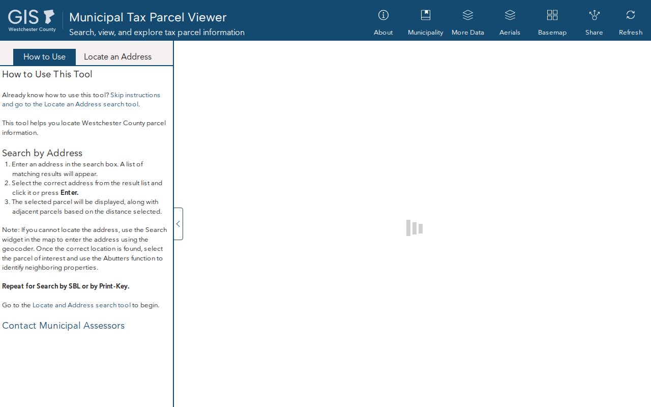
Use the Westchester County Municipal Tax Parcel Viewer to test the legal side of a postal result. Mamaroneck Village Parcels is layer 378. Select the parcel and compare the displayed property address, print key, and municipality. The map is a useful common layer across the two assessment systems, but parcel edges are approximate and should not replace a survey or definitive tax map.
The county parcel viewer is pictured below. Its MUNNAME display and PRINTKEY label provide a better municipal check than a delivery ZIP, especially near the river and the village’s town seam.
A map polygon is still not an occupancy record. Follow the displayed key back to the appropriate town roll or recorded deed when the question concerns ownership or a specific address.
Village of Mamaroneck ZIP Code Address Keys
One address can have several valid identifiers. USPS uses a delivery address and ZIP. A town assessment roll uses a section, block, lot, or print key. A deed uses a legal description and recording reference. GIS uses a parcel polygon and its associated key. A tax-roll record may show a physical situs and a different mailing address. Comparing these fields prevents a postal return from being mistaken for a tax jurisdiction or a current-residence conclusion.
- ZIP code
- A Postal Service delivery geography used to route mail, not a municipal boundary or a list of occupants.
- ZIP+4
- An added four digits that improve mail delivery precision. It does not identify a resident.
- PO Box ZIP
- A ZIP assigned for post-office boxes. It can differ from the physical street address.
- Unique ZIP
- A ZIP designated for one organization or high-volume recipient. No such village ZIP was established in the research.
- Carrier route
- A delivery sequence used by the Postal Service. It is not a legal parcel boundary.
Researchers should retain the postal ZIP, town side, parcel key, situs, and mailing address as separate fields. They answer different questions and can legitimately differ.
Village of Mamaroneck ZIP Code Voter Match
The New York voter form includes ZIP information, but it is an individual exact-match check rather than a postal directory. It requires Westchester County, last name, first name, date of birth, ZIP, and address details. There is no public streetwide or ZIP-wide voter browse. A full voter file is separately restricted to an elections purpose, and confidential registrations are excluded from public inspection and copying.
| Lookup field | ZIP-related role |
|---|---|
| County | Choose Westchester before running the individual check. |
| Name | Use last and first name for the named person, with sensible spelling variants. |
| Date of birth | Required in month/day/year form for an exact individual match. |
| ZIP and address | Refine one supplied registration; they do not create a residents list. |
The NYS Voter Lookup is appropriate when enough information is already known. For broad, non-personal context, use the state’s aggregate election statistics rather than trying to infer people from a ZIP.
Village of Mamaroneck ZIP Code Myth
Myth: a 10543 result proves that an address or person is inside the Village of Mamaroneck. It does not. USPS says a ZIP lookup does not verify that a person or company is at an address, and the 10543 delivery area reaches outside the village. Conversely, a regional reference in 10538 or 10580 can point to nearby geography without becoming normal village street coverage. The correct answer comes from the full address, the town assessor, and the county parcel layer.
Boundary reminder. A delivery ZIP is a strong mail clue, but the county parcel viewer and the correct town roll determine the municipal record path.
Town of Mamaroneck’s official material places Larchmont with 10538 and the Village of Mamaroneck with 10543, while the village itself also extends into the Town of Rye. Those facts can coexist because mail geography and village incorporation use different lines.
Village of Mamaroneck ZIP Code Directory Context
Use Census and ZCTA figures carefully. The Village of Mamaroneck had 20,151 residents in the 2020 Census, but that is a village count, not a 10543 count. ZIP areas and Census tabulation areas can include territory outside the incorporated village and may not mirror Postal Service routes exactly. A ZIP population should never be substituted for the village population in a property, election, or local-history question.
For a ZIP-wide research question, pair aggregate statistics with parcel layers and village tax-roll material. The village’s territory has its own boundaries and is divided between two assessment systems, while the Postal Service groups addresses for delivery. Do not treat a postal number as a legal boundary, a population container, or proof that a named person lives at an address.